Henderson County GIS
Contact Information
-
Address
200 N Grove St #86B, Hendersonville, NC, 28792 -
Phone
(828) 698-5124 -
Website
hendersoncountync.gov
Location
About Henderson County GIS
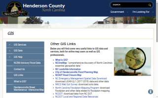
Henderson County GIS is an IT support provider in Hendersonville, North Carolina, serving both online map users and GIS professionals. Its work centers on geographic information systems, the technology behind digital maps and spatial data. The office publishes a directory of GIS data and services, including the City of Hendersonville Flood Planning Map, the NCDOT Road Closure Map, and the NC Emergency Management Spatial Data Download, where LiDAR QL1 data from 2017-2018 is available. It also points users to the NRCS Web Soil Survey for soils data, the North Carolina Floodplain Mapping Program for floodplain data, and NCDOT for transportation data. Additional resources cover the NC DEQ GIS Online map services, the NC Geodetic Survey, the NC Geological Survey, and The National Map from the USGS, where topography and hydrography data can be downloaded. The office maintains links to Esri and ArcGIS Online, the USGS Map Locator for US Topo GeoPDFs, USGS TopoView for historical topographic maps, the US Forest Service Geospatial Data Discovery, CalTopo, USGS Streamer, and National Geographic PDF Quads. It also provides GIS layers through ArcGIS REST services, including Henderson County GIS layers, USA Topo Maps, NCOneMap REST Services, North Carolina Statewide Orthophotos, Statewide Parcels, and Statewide Roads. A tool for converting degrees-minutes-seconds to decimal degrees is offered as well. The office holds a rating of 4.00 from the customers who have reviewed it.
The office sits on North Grove Street in Hendersonville, less than a tenth of a mile from the Henderson County Courthouse and about a tenth of a mile from the Henderson County Sheriff's Office and Dr. Martin Luther King Jr. Memorial Park. North King Street is roughly a tenth of a mile away, South King Street about two tenths of a mile, and Historical Downtown about two tenths of a mile.
Its positive rating reflects the experience of the customers who have reviewed it.
More Businesses in Hendersonville, North Carolina
- HearingLife of Hendersonville NCBizScore 75
- Auto AdvantageBizScore 74
- Wilson Roofing GroupBizScore 73
- Brown Haven Homes: Asheville OfficeBizScore 69
- AdventHealth HendersonvilleBizScore 69
- ALLCHOICE InsuranceBizScore 68
- FOX-N-OTTER Escape Rooms - HENDERSONVILLEBizScore 68
- Champion Comfort Experts of HendersonvilleBizScore 68
- Kanuga Tire & Auto CareBizScore 66
- Langer Law Firm Ticket DefenseBizScore 65
Browse: Businesses in Hendersonville, NC · IT Support in North Carolina · Businesses in North Carolina
AI engine reads
Read by AI engines 4 times in the last 30 days.
Counted from AI crawler and assistant visits to this page, identified by user agent.
See the full AI visibility report for this business